

- Graphic
- Map
Earthquake impacts to Kaikōura's rocky shores
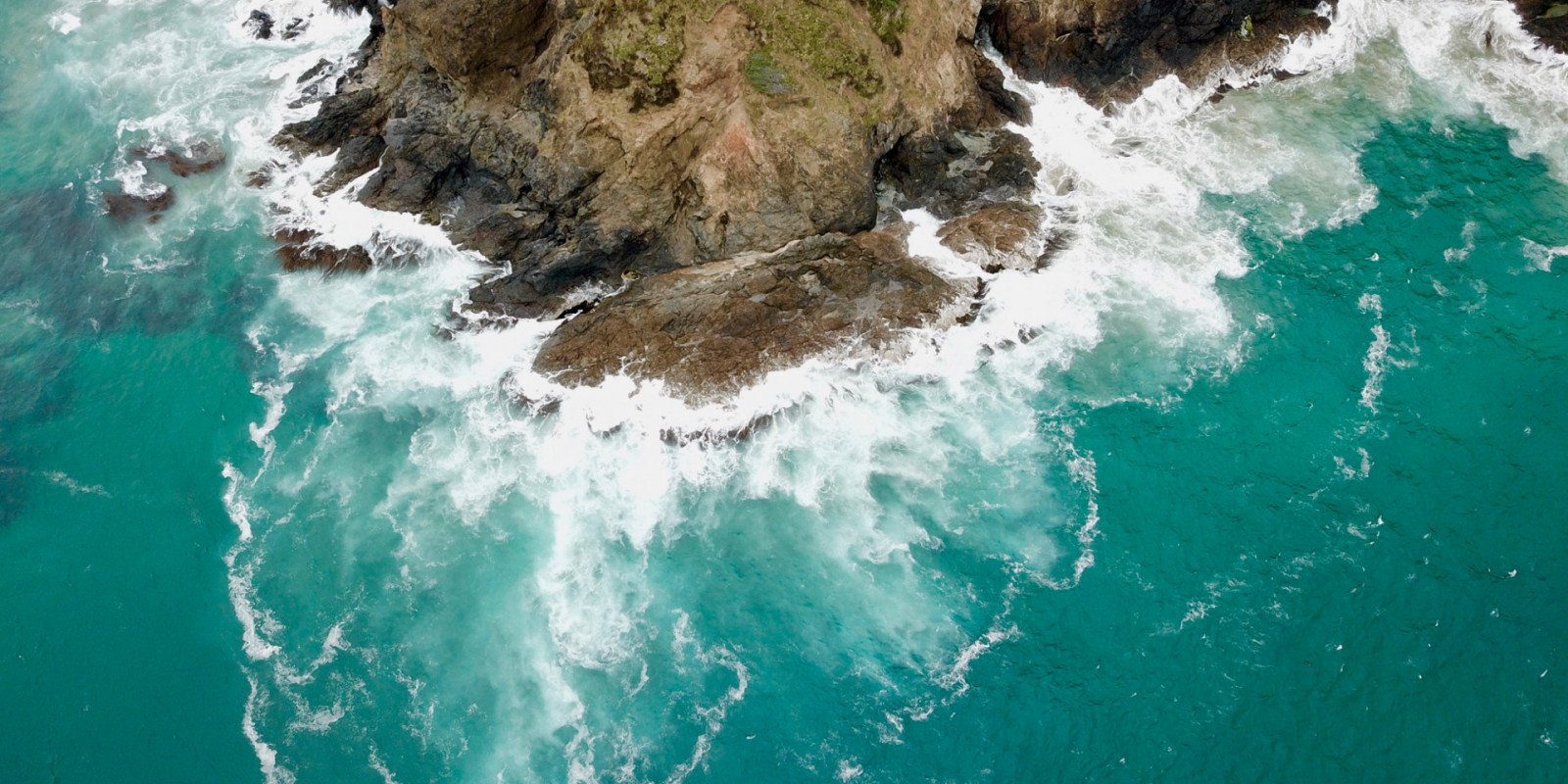
This StoryMap is a visual summary of how composite images from standard RGB (red-green-blue) cameras and multispectral cameras were used to monitor kelp and seaweed biodiversity in multiple sites along Kaikōura's coast.
The uplift of Kaikōura’s coastline following the November 2016 earthquakes caused an unprecedented loss of kelp forests, which provide many important ecosystem services.
Aerial imagery of kelp and seaweed habitats was captured by drones to monitor recovery.
This StoryMap is a visual summary of how composite images from standard RGB (red-green-blue) cameras and multispectral cameras were used to monitor kelp and seaweed biodiversity in multiple sites along Kaikōura's coast.
These images can inform sustainable management of kelp forests in the region by identifying areas that need protection to support kelp forest recovery.
This technology could be used nationwide to support the management of coastal ecosystems for future generations.
Sites that were mapped
- Wairepo Reef
- South Bay Reef
- Paia Reef
- Omihi Reef
- Oaro Reef
- Waipapa Reef South
- Waipapa Reef North
