Image
Credit: Crispin Middleton NIWA 2018

Spatially-explicit decision support tools

We developed tools to help decision-makers explore how best to use and share marine spaces.

Project LeaderDurationBudget
Carolyn Lundquist (NIWA/University of Auckland)April 2016 – June 2019$570,000

Overview

We used 2 modelling approaches to help predict how best to manage ocean spaces in Aotearoa New Zealand. The models consider multiple resource uses, needs, Māori and stakeholder values, and the implications these have for biodiversity and ecosystem health.

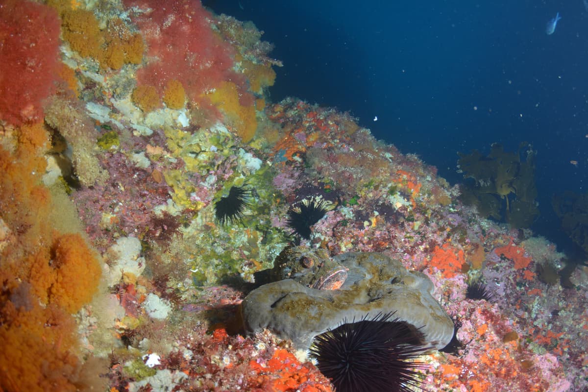
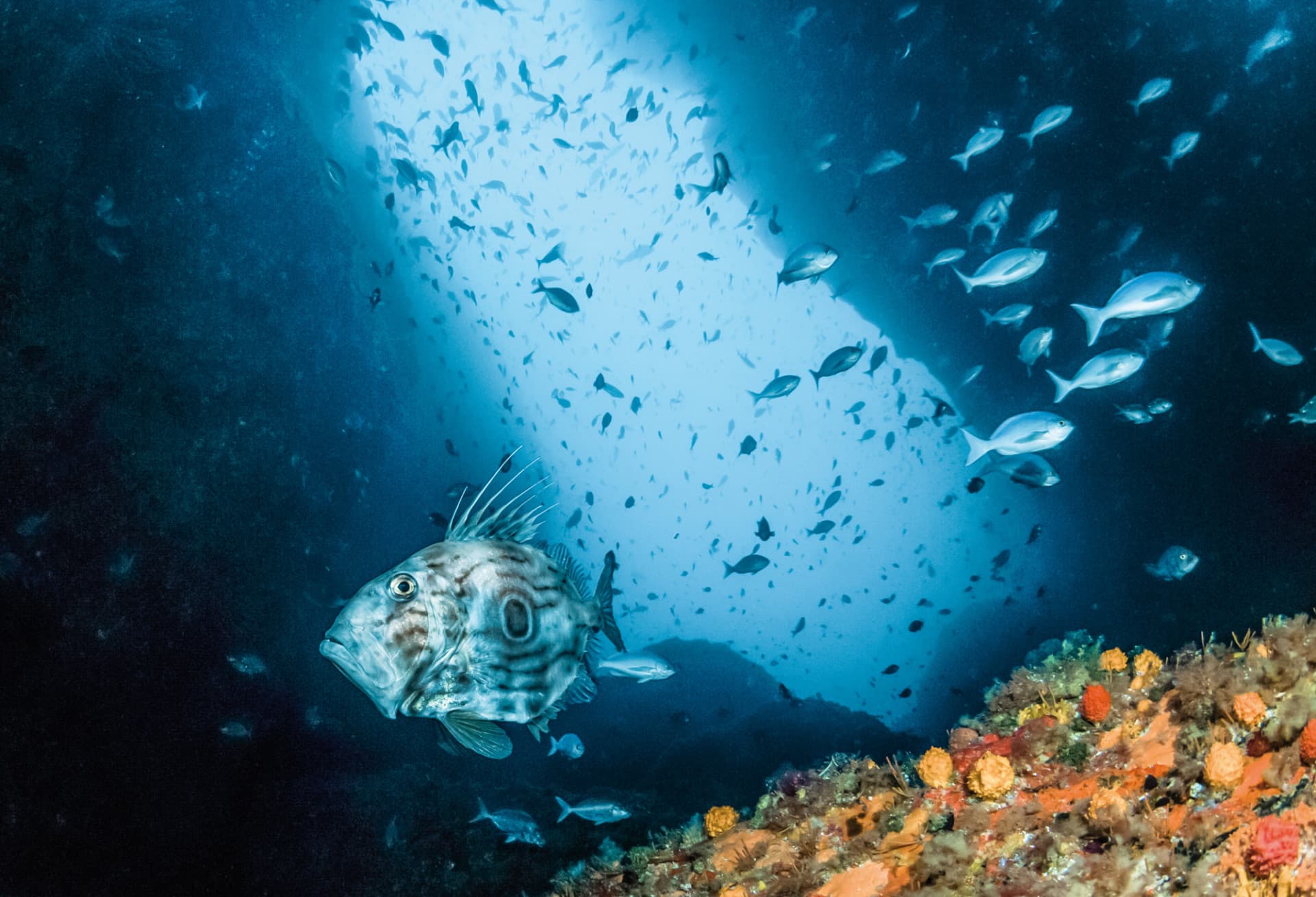
The first model evaluates trade-offs between preserving and using marine resources. On one hand, conserving and protecting biodiversity, while on the other hand, using or taking resources through activities such as fishing, tourism, and aquaculture. The model needs accurate biodiversity data, so we built a tool that predicts the number of species and their distribution in an ecosystem. For example, the tool can predict the distribution of John Dory in an ecosystem using information about the kind of environments that John Dory live in including tidal current speeds, temperature and sediment types.

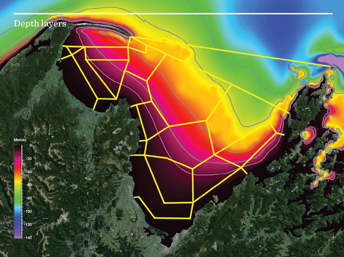
The second model examines cumulative effects of multiple disturbances (such as fishing and sedimentation) on animals living on the seafloor. This model is informed by current and historical disturbances in Tasman and Golden Bays, and how these disturbances overlap in space and time.

A key challenge in large-scale management of the marine environment is evaluating the uncertainty associated with the data. Within both models, we developed techniques to assess whether uncertainty – in data from biological (living) and physical (non-living) parts of an ecosystem, or socio-cultural values – will affect model outcomes. 

We developed these tools with involvement from managers in central and local government, Māori, and community and stakeholder organisations to ensure they are ‘fit for purpose’ and applicable within existing management systems.

Related News

Project proposal

723 KB | pdf

Location

This project is not location specific.
This is a national project.

Tools & Resources

This project has produced or contributed to:

Filling gaps in marine data using Gradient Forest models
Guidance
This describes how large numbers of different data sets can be effectively pooled to group marine species into 'community assemblages'. These assemblages can be used to identify biodiversity hotspots and explore trade-offs resulting from management decisions.
View
Effects of benthic protection extent on recovery dynamics of a conceptual seafloor community
Academic publication
Stephenson F, Bulmer RH, Meredyth-Young M, Meysick L, Hewitt JE and Lundquist CJ (2019) Frontiers in Marine Science
View
A New Zealand demersal fish classification using Gradient Forest models
Academic publication
Stephenson F, Leathwick J, Francis M and Lundquist C (2020) NZ Journal of Marine and Freshwater Research 54
View
Examining the utility of a decision-support tool to develop spatial management options for the protection of vulnerable marine ecosystems on the high seas around New Zealand
Academic publication
Rowden AA, Stephenson F, Clark MR, Anderson OF, Guinotte JM, Baird SJ, Roux MJ, Wadhwa S, Cryer M and Lundquist CJ (2019) Ocean and Coastal Management 170: 1-16
View
Investigating changes in estuarine ecosystem functioning under future scenarios
Academic publication
Hillman J, Stephenson F, Thrush S and Lundquist Carolyn (2020) Ecological Applications
View
Using Gradient Forests to summarize patterns in species turnover across large spatial scales to inform conservation planning
Academic publication
Stephenson F, Leathwick JR, Geange SW, Bulmer RH, Hewitt JE, Anderson O, Rowden, A & Lundquist C (2018) Diversity and Distributions 24(11) 1641-1656
View
Metadata catalogue: Decision support tools project
Dataset
This project has produced datasets. You can find out about these datasets through our metadata catalogue.
View

Related projects & activities

Image
Ecosystem models
We developed simulation models for the Tasman and Golden Bays marine ecosystem to test what is likely to happen in different scenarios.
More
This project has produced or contributed to
Image
Credit: Leigh Tait NIWA
Measuring ecosystem services and assessing impacts
We developed new ways to measure and map the ecosystem services provided by marine ecosystems.
More
This project has produced or contributed to
Image
Participatory tools
We are developing web-based tools to enable New Zealanders to interact with and use knowledge generated by our research.
More
This project has produced or contributed to
Image
What could EBM look like in Tasman and Golden Bays?
We are investigating how to successfully put EBM into practice in Aotearoa New Zealand’s marine environment.
More
This project has produced or contributed to
Image
Novel risk assessment tools for EBM
We are reviewing new methods to help assess and manage risks to Aotearoa New Zealand’s marine ecosystems.
More
This project has produced or contributed to
Image
Mauri Moana, Mauri Tangata, Mauri Ora
We explored ways to assess the values New Zealanders hold for the marine environment.
More
This project has produced or contributed to